


Introduction
This page contains background information about the geography of the Rwenzori Mountains located on the border of Uganda and the Democratic Republic of the Congo.
Jump to: Geology • Climate • Glaciers • Past Glacial Extents and Ice Ages • Vegetation • Wildlife • Wildfires and Floods
Rwenzori Geography
Geology
Of the three mountains in Africa that still support glaciers today, two (Mt. Kenya and Kilimanjaro) are rift-valley volcanoes, and the third (Rwenzori) is an extreme expression of rift-mountain uplift (horst). The Rwenzori Mountains are located in the western arm of the East African Rift Valley, where tectonic plates are pulling apart (in millions of years, this will be a new sea floor, like the Red Sea). The rifting causes some blocks of land to rise and others to fall. Rwenzori rock types include quartzite, granite, gneiss, and amphibolite that date to the Precambrian, >570 million years old (around the time when multi-cell life forms first appeared)!

3D model of the central Rwenzori on Sketchfab.
Climate
The Rwenzori Mountains (~0 degrees North latitude, ~30 degrees East longitude; highest peak: Mt. Stanley, 5109 m above sea level (asl)) are located nearly on the equator. It is relatively hot and humid at the base of the mountains and temperatures at the mountain peaks are generally below freezing. The slopes of the Rwenzori receive ~2-3 m of precipitation each year and have >90% humidity year round, with two rainy seasons in the boreal spring and fall. Due to the high rainfall, visitors commonly note an abundance of mud along trails which parallel and sometimes cross rivers flowing along the bottoms of steep-sided valleys.


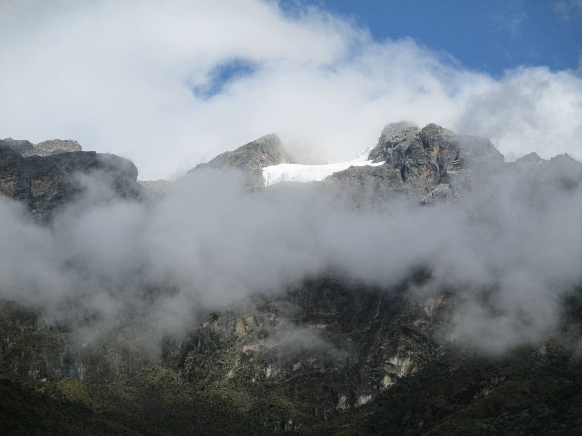
Glaciers
Today glaciers in the Rwenzori exist above ~4400 m asl on the slopes of Mt. Stanley, Mt. Speke and Mt. Baker, the three highest peaks in the range. Since initial measurements in the early 1900s, Rwenzori glaciers have shrunk from an estimated total area of ~6.5 square km in the early 1900s to ~1 square km in 2003 (Taylor et al., 2006). Should recession continue at its current rate, remaining glaciers are predicted to disappear entirely within the next few decades.

Rwenzori peaks that currently host glaciers.

Glacier on Mt. Stanley.
Past Glacial Extents and Ice Ages
In general, glaciers shrink when climate warms and grow when climate cools. Observations, historical photographs and satellite imagery can be used to document the recession of glaciers since the early 1900s, but how do we understand how glaciers have changed over longer time periods? To go back in time, geologists search for signs left by ancient glaciers including large wide “U-shaped” valleys carved by flowing ice and “moraines” or ridges of rock debris deposited at the melting edge of a glacier. Moraines mark the extent of past glaciers and remain even after the ice melts away. There is ample evidence that, in the past, the Rwenzori hosted large glaciers that flowed down the mountain slopes to elevations lower than ~3000 m asl.
Our research team works in mountains around the world, including the Rwenzori Mountains, to map and determine the age of ancient glacial evidence (e.g., moraines). We are comparing records of how glaciers changed during and since the last Ice Age all over the world to understand the climate conditions that influenced Ice Age cycles (i.e., ~100,000-year cycles during which Earth experiences cold conditions with large ice sheets (~90,000-years long) and warm conditions with smaller ice sheets (~10,000-years long)).

The upper Nyamugasani valley shows evidence of bedrock surfaces that were smoothed (eroded) by flowing ice.

Moraines mark the past of a glacier in the lower Mubuku valley – these moraines are heavily vegetated now. The glacier flowed from left to right in the image.

Moraines mark the past extent of a glacier in the upper Nyamugasani valley – these moraines are covered with large, light-colored boulders. The glacier flowed from left to right in the image.
Vegetation
There is an incredible diversity of vegetation in the Rwenzori some of which is unique to this African alpine environment. Evergreen afro-alpine and montane vegetation dominate within the Rwenzori, and there is a distinct altitudinal zonation in vegetation. Above ~4000 m asl vegetation is sparse, with mosses and lichens common on exposed bedrock surfaces. While we do not have expertise in Rwenzori vegetation, we are in awe of its beauty.


Wildlife
The Rwenzori are inhabited by a range of animals including forest elephants, blue monkeys, black-fronted duiker, sunbirds, turacco, three-, two- and one-horned chameleons, earthworms over two-feet long and butterflies in many sizes and colors. Again, we are not experts in Rwenzori wildlife, but are amazed by its diversity and ability to thrive in alpine environments.


Wildfires and Floods
In recent years, the Rwenzori Mountains have experienced wildfires and flooding. We observed the aftermath of a large wildfire that occurred in the southern part of the range in early 2012. As described above, the mountains receive over 2 m of precipitation per year and soils can be saturated. Intense rain storms can cause rivers to flood and steep, unstable valley walls to slip. Muddy storm runoff is able to carry larger sediment sizes, which can cause more erosion of river banks and damage buildings and bridges along the way. Villages near the mountains such as Kilembe, Uganda, have experienced the devastating impacts of flooding. Here is a link to a United Nations Development Program report about flooding and risk management in the Rwenzori.


Photos of the upper Nyamugasani valley in June 2021.